Argal Reservoir
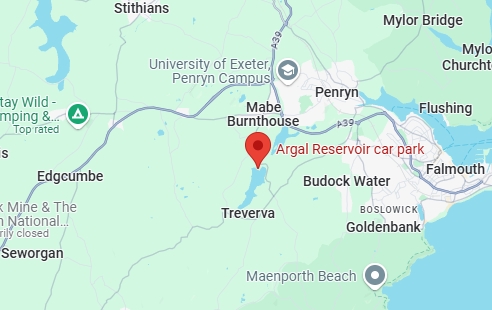
Location: TR11 5PE
Trail length: 1.2 miles
Facilities: Car parking, Children’s play area
Follow the 2km circular lake trail for a picturesque round lake walk; the path passes through woodlands, wetlands and meadows, providing stunning views of the lake, Mabe church and the wider landscape. Look forward to a beautiful display of bluebells in the spring; recently, these gorgeous flowers have flourished due to the Countryside Team’s management of bracken in the area. There are expansive green spaces and a children’s play area, providing a great spot for a picnic or barbeque.
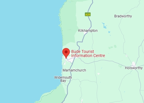
Bude Canal and Marshes
Location: EX23 8LD
Trail length: 2.5 miles
Facilities: Accessible parking, Toilets & Bird Hide
Bude Canal and Marshes is a rural gem that stretches into the heart of Bude. A stunning combination of, freshwater canal, damp grassland and marsh at Pethericks Mill, Reedbed in the Local Nature Reserve. With a level surfaced tow path of 2.5 miles starting alongside the harbour winding up the valley to Helebridge. The tow path passes two inland working locks giving the passer by a flavour of the intriguing history of the canal and its environs.
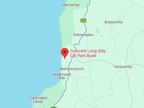
Bude Canal – South West Coast Path
Location: EX23 8LE
Trail length: 6.0 miles
Facilities: Accessible Parking
A gentle stroll along Bude’s historic canal, through a peaceful pastoral landscape with a wealth of wildlife, returning via the Coast Path with its tremendous sea views. A fine route in spring, when there are ducklings and even cygnets on the canal, the hedges are full of primroses and celandines and warblers sing in the blossom-covered bushes. It is good in autumn too, when pipits and buntings find rich pickings in the stubble of the newly-harvested fields. Apart from a low hill between the canal and the Coast Path, the walk is flat, with no stiles. Accessible car parking can be found at The Crescent Car Park.
The Camel Trail:
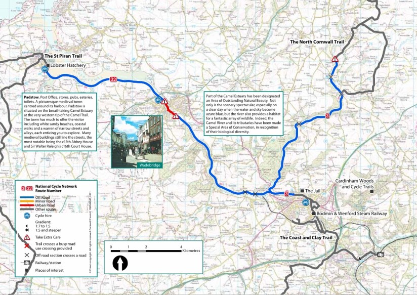
Location: PL28 8DA, PL27 7AP & PL31 2PN
Trail length: 18 miles
Facilities: Accessible parking, Wheelchair tandem bike hire, Changing Places toilet
The Camel Trail is an 18 mile largely traffic free, surfaced and virtually level multi use trail. It provides access to the beautiful Cornish countryside along a disused railway line between Wenfordbridge, Bodmin, Wadebridge and Padstow. The trail is suitable for walkers, cyclists, horse-riders and wheelchair users. For disabled parking the best places are Railway car park in Padstow (PL28 8DA), Piggy Lane car park in Wadebridge (PL27 7AP) & Scarlett’s Well Road in Bodmin (PL31 2PN). Bridge Bike Hire in Wadebridge have wheelchair tandems you can hire and a Changing Places toilet.
Cardinham Woods – Lady Vale Route
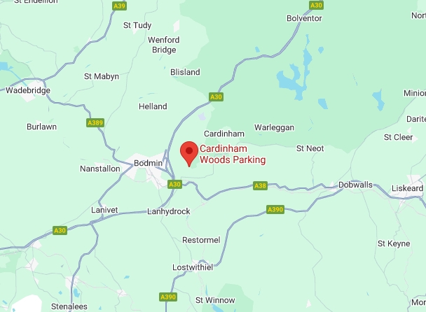
Location: PL30 4AL
Trail Length: 1.7 miles
Facilities: Accessible toilet, Accessible parking, Cafe & Tramper hire
Cardinham Woods’ most popular route is the streamside Lady Vale walk. The track follows the river upstream to Lady Vale Bridge, which takes its name from The Chapel of Our Lady that stood beside the river during the 12th century. Enjoy dappled shade and the sound of rippling water. An easy-going route along Cardinham Water, suitable for wheelchairs and pushchairs. For a shorter walk, cross the Centenary Bridge to return to the car park and cafe.
Goss Moor Trail
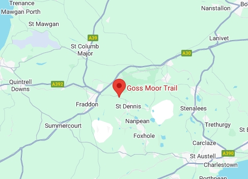
Location: PL26 8BY
Trail Length: 7.0 miles
Facilities: Car parking
Goss Moor is a 480 hectare National Nature Reserve (NNR) which is owned and managed by Natural England. There is a lot to see and do as you explore Goss Moor using the multi-use trail.
The 7 mile (c. 12 km) circular trail is mostly flat and relatively easy – much of it off road – allowing disabled and novice walkers and cyclists easy and safe access to the moors. The trail is surfaced to be suitable for walking, cycling, horse-riding and for wheelchair or mobility scooter users and buggies. Warning: There are gates to open on parts of the trail. Parking is probably best at Dommellick Hill PL26 8BY
Mount Edgcumbe Country Park – Tree Trail
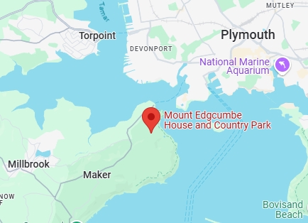
Location: PL10 1HZ
Trail length: 2.0 miles
Facilities: Accessible parking Accessible toilets, Tramper Hire, Cafe, Shops, House & Gardens
This trail has been designed to introduce you to 17 interesting tree species within the Country Park. The route followed is 3km (2 miles) long and will take 60-90 minutes. The entire route is suitable for prams or tramper (available for hire at the park), except for a small section, which can be readily by-passed. There’s a disabled car park on the driveway to the house or you can use dry walk car park. Accessible toilets can be found in the cafe and in dry walk car park.
Padstow to Gun Point
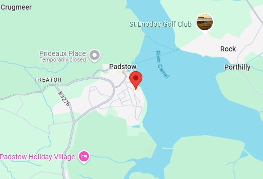
Location: PL28 8DA
Trail length: 2.6 miles
Facilities: Accessible parking, Accessible toilets
A level walk around the harbour with a slight gradient in places as the path continues along the estuary. The surface is tarmac with some compacted gravel surfaces. Accessible toilets and car parking is available in the Railway Car Park.
